
Plastic Litter Project 2018
Plastic Litter Project (PLP) has a new dedicated site. Please redirect to: http://plp.aegean.gr/
The first PLP was conducted in 2018 (PLP2018) as an innovative exploratory application of open-access satellite imagery and unmanned aerial systems (UAS) data for the remote detection of floating marine plastics in natural waters. Three large artificial 10×10 m plastic targets were designed and constructed, matching the Sentinel-2 RGB and NIR bands spatial resolution. During the second PLP (PLP2019), 10 smaller targets were created in order to be closer to reality and to examine the limitations of the detection with Sentinel-2 images. In PLP2020 we work towards creating a reference target for the scientific community, and extending deployment duration in real conditions with the construction of semi-permanent targets. Please redirect to our new dedicated webpage: http://plp.aegean.gr/
___________________________________________________________________________
Drone Mapping and Satellite Testing for Marine Plastic on Aegean Sea
Plastic Litter Project 2018 #MRSG_PLP_2018
___________________________________________________________________________
Project Description (May 2018)
A test project to detect artificial plastic targets on the sea surface using UAV and satellite images technology. A scholar team consisting of university students and academic staff focusing on the tracking of plastic litter.
Fact Table
- University of the Aegean, Department of Marine Sciences
- Marine Remote Sensing Group
- Area: Marine Litter
- Date: June 2018
- Project Size: 3 targets with plastics 10 x 10 m
- Equipment: UAVs, dedicated cameras
- Satellites: Sentinel-1 & 2
Project Description
Marine Litter is a global problem affecting all the oceans of the world. Millions of plastics end up in the seas affecting the marine ecosystem. Several initiatives have been planned from global players towards detection, monitoring and cleaning. State of the art techniques are needed for the detection and quantification of the marine plastics in the sea water. Unmanned Aerial Systems and satellites can be used in this direction. Already, the scientific community and space agencies are working towards the specifications of sensors detecting and quantifying marine liter.
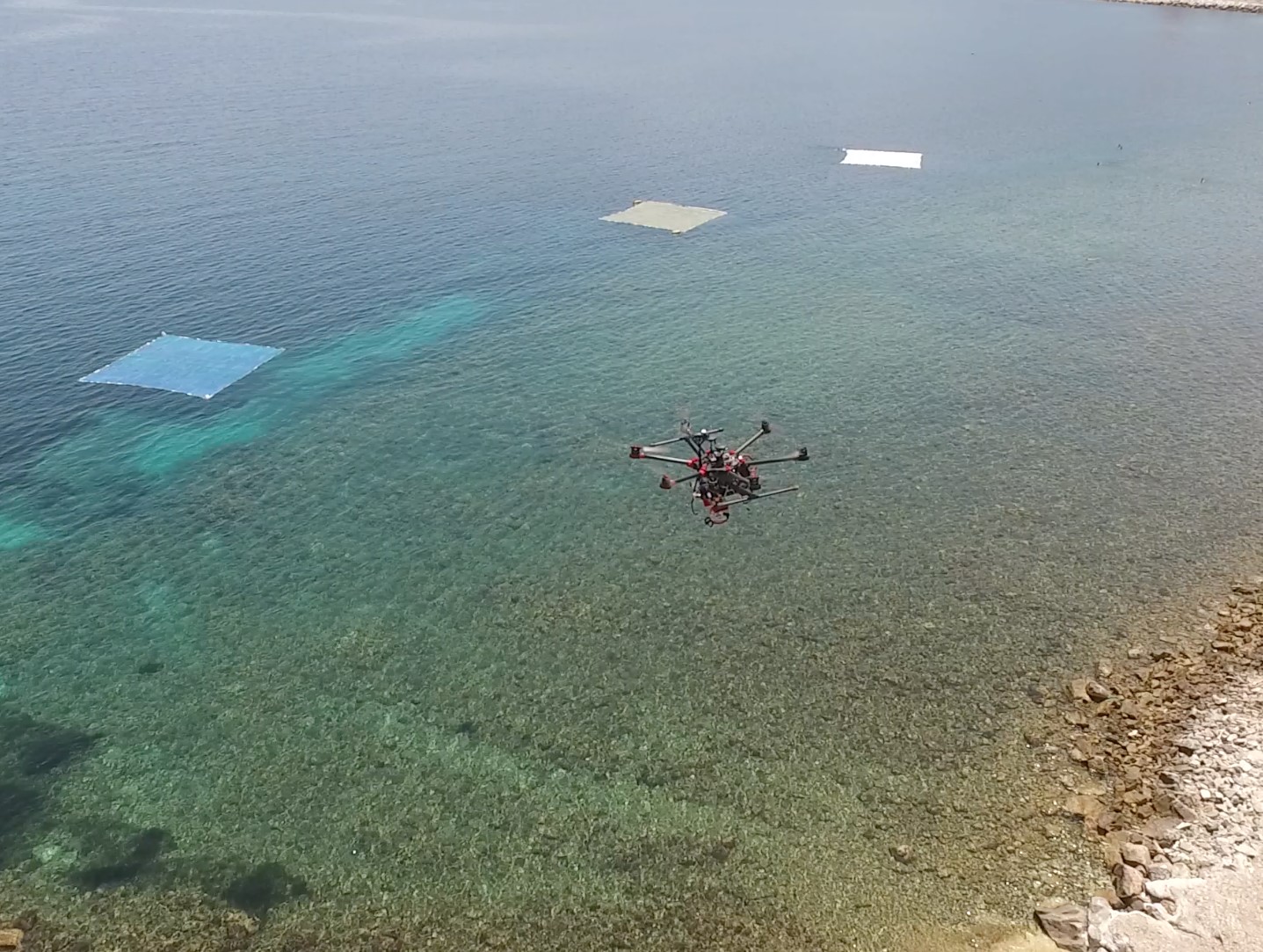
This project will use artificial marine litter targets to be detected form European Satellites Sentinel-1 and Sentinel-2. Also, UAV’s will be used to detect and quantify the volume of the litter on the sea surface with dedicated cameras. Inter-comparison between data from satellites and UAVs will release the advantages and disadvantages of the detecting systems.

Artificial Marine Litter Targets
Three “targets” will be created 10 x 10 m wide containing a) plastic bottles, b) plastic bags and c) fishing net. The targets’ frame will be 20 inch PVC pipe and will be covered with plastic net. The containing targets will be attached in the net. The project planning is to use 3700 plastic bottles, at least 138 plastic bags and 200 sqm fishing net. Targets will be created from undergraduate students from Department of Marine Studies / University of the Aegean. The experiment is devoted to the Word Environment Day, 5th June.
Data Acquisition
At least 3 drones will be used for mapping containing, RGB, musti-spectral and thermal cameras. Dates will be selected according to weather status and Sentinel-1 / Sentinel-2 satellites acquisition times.
Expected results
Image analysis, image processing algorithms and satellite measurements will be used to evaluate the ability of satellites to detect marine litter on the sea surface.

Advantage of the New Technology
This experience will prove the usefulness of UAV technology in marine sector:
- Acquisition will be made in remote areas with difficult access,
- Maps will be acquired at low cost and high resolution (typically a few centimeters per pixel)
- Surface models will be generated at true scale for measuring distance, thickness and volumes
- Features from marine litters will be observed from the most favorable point of view
https://www.facebook.com/MRSG.Aegean
https://www.instagram.com/UoA_mrsg
Πείραμα καταγραφής πλαστικών στο θαλάσσιο περιβάλλον του Αιγαίου από ΣμηΕΑ και προσπάθεια εντοπισμού από δορυφορικά συστήματα
Plastic Litter Project 2018 #MRSG_PLP_2018
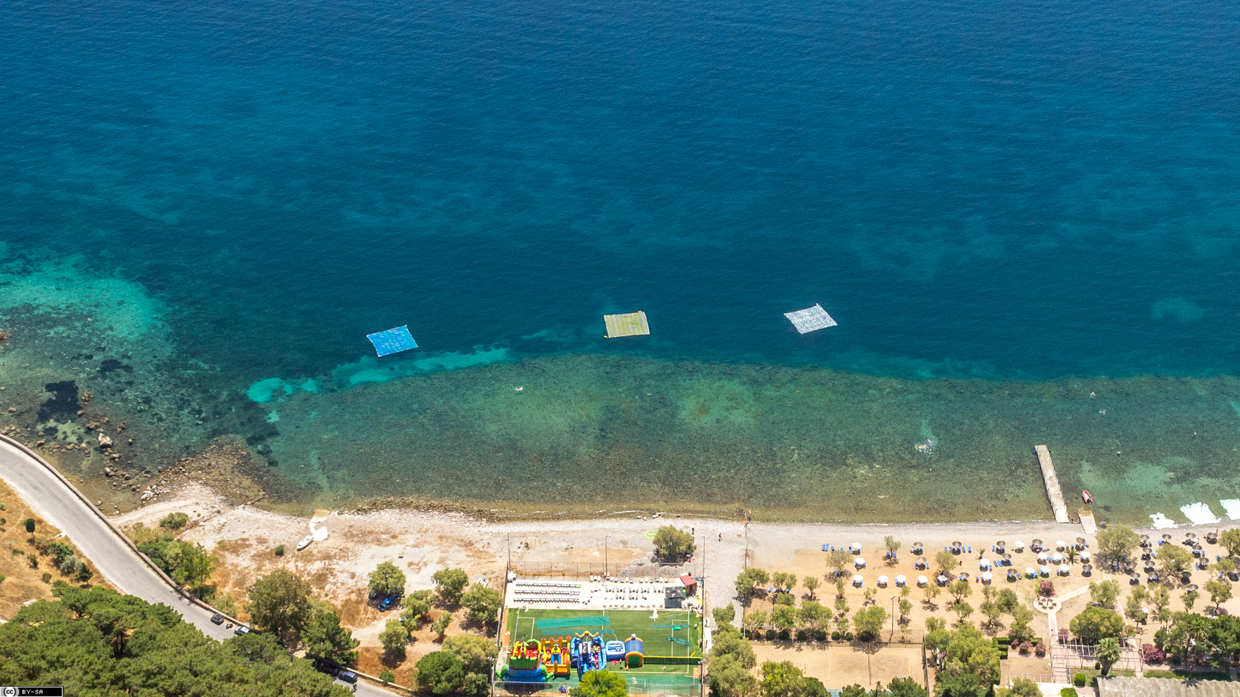
Με επιτυχία πραγματοποιήθηκε από την Ομάδα Θαλάσσιας Τηλεπισκόπησης του Πανεπιστημίου Αιγαίου το πρωτοπόρο πείραμα εντοπισμού και την ποσοτικοποίησης πλαστικών απορριμμάτων στην επιφάνεια της θάλασσας την Πέμπτη 7 Ιουνίου 2018 στην πλαζ «Τσαμάκια» Μυτιλήνης. Στόχος του πειράματος ήταν ο εντοπισμός από απόσταση, μεγάλων επιφανειών πλαστικών απορριμμάτων στην επιφάνεια της θάλασσας, που θα επιτρέψει την στοχευμένη και αποτελεσματικότερη παρέμβαση στην απομάκρυνση τους.
Τρείς πλωτοί τεχνητοί στόχοι, 10 x 10 m ο καθένας, περιείχαν 3600 πλαστικά μπουκάλια νερού 1.5 lt, 185 πλαστικές σακούλες μιας χρήσεως και 200 m2 δίχτυα ψαρέματος και τοποθετήθηκαν στη παράκτια περιοχή της πλάζ. Τέσσερις δορυφόροι (Sentinel-1, Sentinel-2, TeraSAR-X και WorldView-3) συνέλεξαν δεδομένα πάνω από την περιοχή του πειράματος αποτυπώνοντας τα πλαστικά με πολλούς διαφορικούς τρόπους (σε πολλαπλά μήκη κύματος και διαφορετικές χωρικές αναλύσεις).
Ταυτόχρονα, τέσσερα Συστήματα μη Επανδρωμένων Αεροσκαφών – (ΣμηΕΑ ή drones) της Ομάδα Θαλάσσιας Τηλεπισκόπησης χρησιμοποιήθηκαν για να χαρτογραφήσουν με πολύ μεγάλη ακρίβεια την θέση και την πυκνότητα των πλαστικών σε συγκεκριμένες φασματικές περιοχές (ορατού, υπέρυθρου και θερμικού). Επιπρόσθετα, αεροφωτογραφίες συλλέχθηκαν από ελαφρύ αεροσκάφος σε μέσο ύψος.
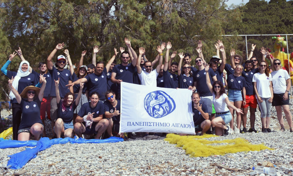
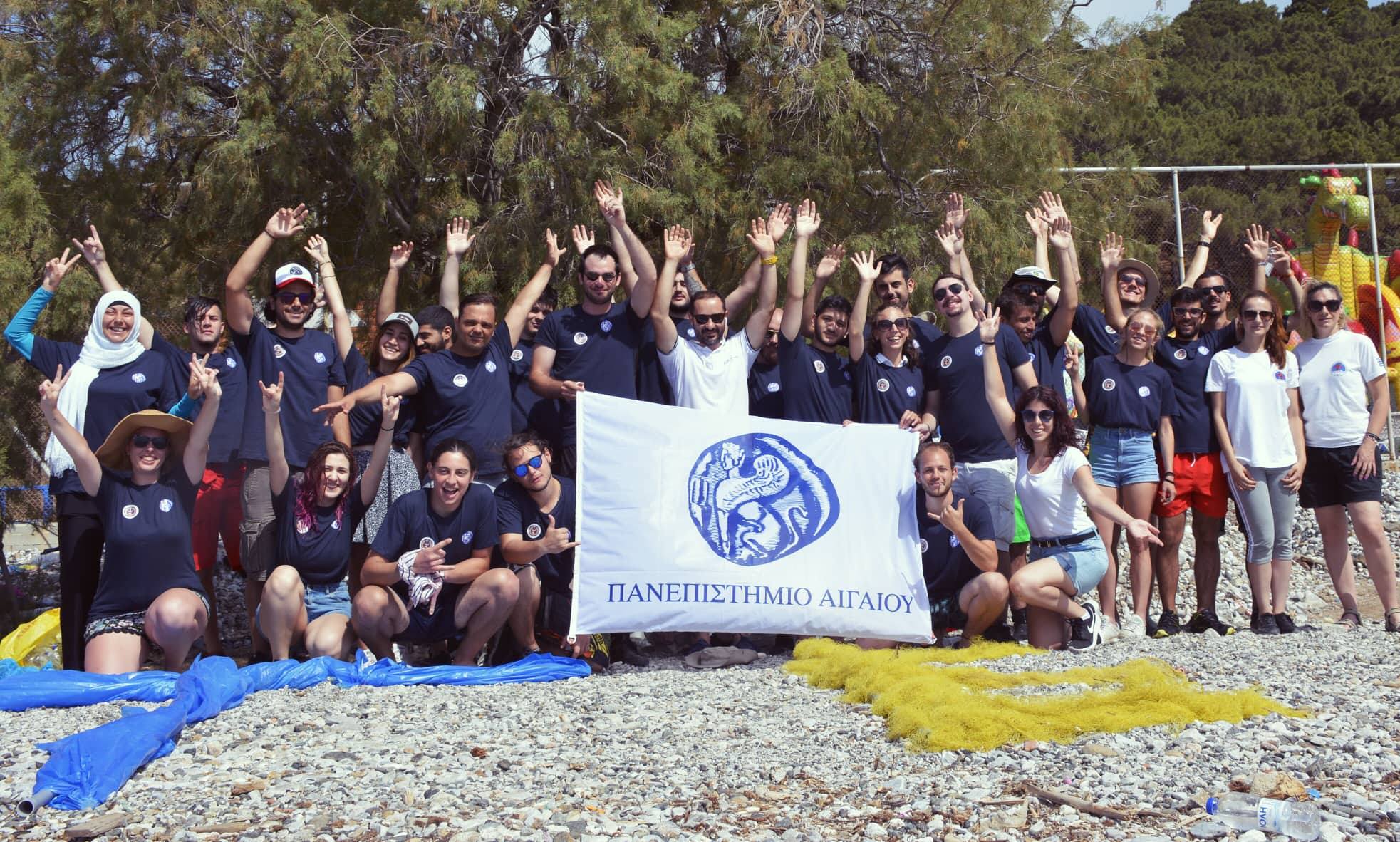
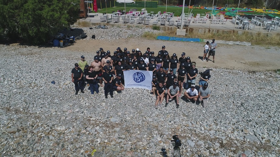
Οι στόχοι ήταν ορατοί σε όλα τα δορυφορικά δεδομένα και θα αποτελέσουν το πρωτογενές υλικό για την δημιουργία αλγορίθμων εντοπισμού από απόσταση των πλαστικών στη θάλασσα. Για την εκπόνηση του πειράματος συμμετείχαν πάνω πάνω από 30 φοιτητές του Τμήματος Επιστημών της Θάλασσας του οποίους αξίζουν πολλά συγχαρητήρια για την εθελοντικής τους προσφορά. Πειράματα σαν αυτό συνδέουν τις παρεχόμενες γνώσεις που δίνονται στους φοιτητές μας με τις διεθνείς ερευνητικές εξελίξεις στην επιστήμη σε αντικείμενα με άμεση σύνδεση με την κοινωνία.
____________________________________________________________________
Περιγραφή πειράματος (Μάιος 2018)
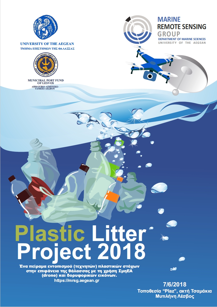
Το Plastic Litter Project 2018 αποτελεί ένα πείραμα εντοπισμού (τεχνητών) πλαστικών στόχων στην επιφάνεια της θάλασσας με τη χρήση ΣμηΕΑ (drone) και δορυφορικών εικόνων. Το πείραμα διεξάγεται από ομάδα προπτυχιακών φοιτητών και ακαδημαϊκών που ασχολούνται με την παρακολούθηση πλαστικών απορριμμάτων στο θαλάσσιο περιβάλλον.
Βασικές πληροφορίες για την δράση:
- Πανεπιστήμιο Αιγαίου, Τμήμα Επιστημών της Θάλασσας, Ομάδα θαλάσσιας Τηλεπισκόπησης (Marine Remote Sensing Group)
- Θεματική περιοχή: Πλαστικά στο θαλάσσιο περιβάλλον
- Ημερομηνία: Ιούνιος 2018
- Τεχνητοί στόχοι πλαστικών: 3 στόχοι-πλατφόρμες 10 x 10 m με διαφορετικά πλαστικά
- Εξοπλισμός: Συστήματα μη επανδρωμένων Εναέριων Αεροσκαφών (ΣμηΕΑ), εξειδικευμένες κάμερες καταγραφής σε μήκη κύματος όμοια με τα δορυφορικά δεδομένα
- Δορυφόροι: Ευρωπαϊκοί δορυφόροι Sentinel-1 & 2
Περιγραφή του πειράματος:
Τα θαλάσσια απορρίμματα αποτελούν ένα πρόβλημα που πλήττει όλους τους ωκεανούς. Εκατομμύρια πλαστικών καταλήγουν στις θάλασσες και επηρεάζουν με δυσμενή τρόπο τα θαλάσσια οικοσυστήματα. Διάφορες πρωτοβουλίες έχουν πραγματοποιηθεί από φορείς για τον εντοπισμό, την παρακολούθηση και την απομάκρυνση των πλαστικών απορριμμάτων από τους υδάτινους αποδέκτες. Σύγχρονες μέθοδοι και τεχνικές απαιτούνται για τον εντοπισμός και την ποσοτικοποίηση των απορριμμάτων. Τα ΣμηΕΑ (drones) και οι δορυφόροι μπορούν να χρησιμοποιηθούν για αυτό το σκοπό. Ήδη, η διεθνή επιστημονική κοινότητα και οι διαστημικές υπηρεσίες εργάζονται για τις προδιαγραφές των αισθητήρων ανίχνευσης και ποσοτικοποίησης των θαλάσσιων πλαστικών απορριμμάτων.
Στο συγκεκριμένο πείραμα, θα χρησιμοποιηθούν τεχνητοί στόχοι πλαστικών (πλατφόρμες απορριμμάτων) που θα ανιχνευθούν από τους ευρωπαϊκούς δορυφόρους Sentinel-1 και Sentinel-2. Επίσης, τα ΣμηΕΑ θα χρησιμοποιηθούν για τον εντοπισμό και την ποσοτικοποίηση του όγκου των απορριμμάτων στην επιφάνεια της θάλασσας με εξειδικευμένες κάμερες. Με την σύγκριση των δεδομένων, που θα συλλεχθούν από τους δορυφόρους και τα ΣμηΕ, θα αναδειχθούν τα πλεονεκτήματα και τα μειονεκτήματα των δύο μεθόδων ανίχνευσης.
Οι πλατφόρμες “στόχοι”:
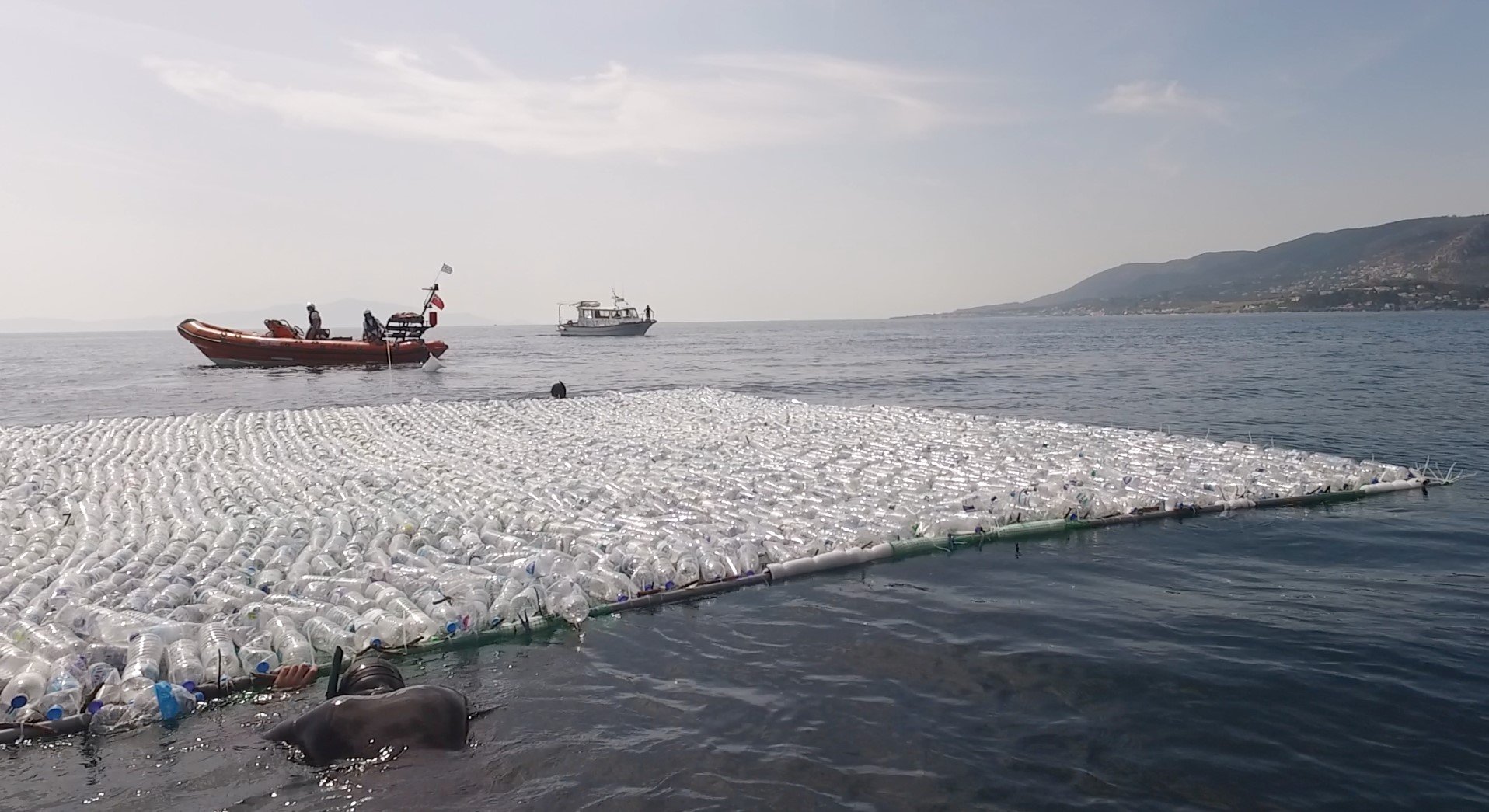
Θα κατασκευαστούν τρεις “στόχοι” μεγέθους 10 x 10 m που θα περιέχουν α) πλαστικά μπουκάλια, β) πλαστικές σακούλες και γ) αλιευτικά δίχτυα. Αρχικά, θα δημιουργηθεί το πλαίσιο των στόχων με σωλήνες PVC 20 ιντσών και στη συνέχεια θα καλυφθούν με πλαστικό δίχτυ. Τα πλαστικά – στόχοι που θα περιέχονται μέσα σε κάθε πλαίσιο θα στερεοποιηθούν πάνω στο πλαστικό δίχτυ. Σύμφωνα με τον προγραμματισμό πρόκειται να χρησιμοποιηθούν γύρω στα 3700 πλαστικά μπουκάλια, τουλάχιστον 138 πλαστικές σακούλες και 200 m^2 αλιευτικού διχτυού. Οι στόχοι θα δημιουργηθούν από προπτυχιακούς φοιτητές από το Τμήμα επιστημών της Θάλασσας του Πανεπιστήμιο Αιγαίου. Το πείραμα είναι αφιερωμένο στην Παγκόσμια Ημέρα Περιβάλλοντος (5 Ιουνίου).
Μέθοδος συλλογής δεδομένων:
Για την καταγραφή των πλαστικών θα χρησιμοποιηθούν τουλάχιστον 3 ΣμηΕΑ, τα οποία θα είναι εξοπλισμένα με κάμερες στο ορατό φάσμα (RGB), πολύ-φασματικές και στο θερμικό φάσμα. Οι ημερομηνία του πειράματος θα επιλεχθεί ανάλογα με τις καιρικές συνθήκες και την χρονική στιγμή κάλυψης από τους δορυφόρους Sentinel-1 / Sentinel-2.
Αναμενόμενα αποτελέσματα:
Θα εξεταστεί η ικανότητα των δορυφορικών δεδομένων και των ΣμηΕΑ στον εντοπισμό των πλαστικών απορριμμάτων στην επιφάνεια της θάλασσας μέσω ανάλυσης εικόνων και αλγορίθμων επεξεργασίας εικόνας.
Πλεονέκτημα της χρήσης νέων τεχνολογιών:
Το πείραμα θα συμβάλλει στην ανάδειξη της χρησιμότητας της τεχνολογίας των ΣμηΕΑ στη θάλασσας ως προς τη:
- Συλλογή δεδομένων σε απομακρυσμένες και δυσπρόσιτες περιοχές,
- Δημιουργία χαρτών με χαμηλό κόστος και υψηλή χωρική ανάλυση (μερικά εκατοστά ανά εικονοστοιχείο),
- Δημιουργία τρισδιάστατων μοντέλων επιφανείας σε πραγματική κλίμακα για την μέτρηση αποστάσεων, πάχους και όγκου πλαστικών,
- Παρατήρηση και καταγραφή πλαστικών απορριμμάτων από πιο την ευνοϊκή θέση.
https://www.facebook.com/MRSG.Aegean
Plastic Litter Project 2019
Plastic Litter Project (PLP) has a new dedicated site. Please redirect to: http://plp.aegean.gr/
The first PLP was conducted in 2018 (PLP2018) as an innovative exploratory application of open-access satellite imagery and unmanned aerial systems (UAS) data for the remote detection of floating marine plastics in natural waters. Three large artificial 10×10 m plastic targets were designed and constructed, matching the Sentinel-2 RGB and NIR bands spatial resolution. During the second PLP (PLP2019), 10 smaller targets were created in order to be closer to reality and to examine the limitations of the detection with Sentinel-2 images. In PLP2020 we work towards creating a reference target for the scientific community, and extending deployment duration in real conditions with the construction of semi-permanent targets. Please redirect to our new dedicated webpage: http://plp.aegean.gr/
———————————————————————————————————————-
Plastic Litter Project 2019 #PLP2019
PLP2019 part of the Project: “EO tracking of marine debris in the Mediterranean Sea from public satellites”, an ESA-(EO Science for Society permanently open call for proposals) funded scheme. The project consortium consists of Argans Ltd (EN) and three research institutes (CNR-ISMAR (IT), Universidad de Cádiz (SP), University of the Aegean (GR)).
Downloadable dataset (April 2020)
Data from PLP2019 can be dowloaded from ZENODO database (https://doi.org/10.5281/zenodo.3752719). The dataset contains:
- Sentinel-2 L1C granules catalogue in a word document named: “PLP2019 Sentinel-2 Image Catalogue”,
- Sentinel-2 L2 subsets after pre-processing with ACOLITE i.e. after atmospheric correction, sun glint removal and land making. Data are given in netCDF format (.nc) in a folder named “S2_satellite_images_nc”,
- UAV images with the plastic targets for each date. UAV images are organised in the folder named “UAV_photos”,
- Point vectors with percentage plastic presence for each Sentinel-2 pixel in the folder “Vector_Points”. Point vectors are given in ERSI vector and are organised by the acquisition date. Also, for each date an Excel file is provided to locate and describe the name of the actual pixel.
Project Description (April 2019)
The experiment will be composed of four artificial targets, with 5X5 m size. The target frames will be constructed solely by PVC tubes of 50 cm in diameter (ø), all joined by PVC welding material and fasteners. A mesh will be installed that will fill the frame, to act as a holding net for the plastics that will be mounted. The controlled targets will be filled with two types of plastics, such as plastic bottles made from PET-1 (Polyethylene terephthalate) and low-density Polyethylene (LDPE) plastic bags. There will be different patterns of the targets (when anchored) such as parallel, single line and square. Also, there will be a mixture of plastics in 2 of the targets and different coverage percentage. In addition, a GPS module will be positioned at the centre (above the sea surface) for further data collection and precise location. The frame construction is essential for the experiment to prevent the loss of plastics and also the GPS housing to be secured. Data will be collected from Sentinel-2 satellites and from UAS (drones) equipped with multispectral cameras.
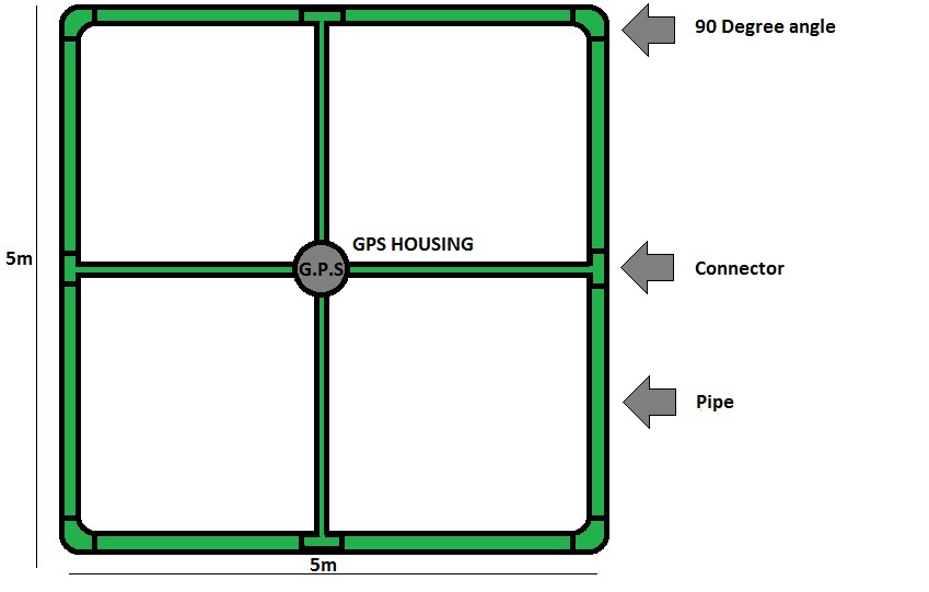
Figure1. Target’s frame construction in schematic form
The plastic bottles will be arranged in strips of around 15 bottles each, and the strips will be secured with fishing line to provide security of plastic loss as well as stability. The bottles will be transparent and will be completely empty of any fluid or solid, with a small chance for some seawater to trickle in through the holes that will be made for the fishing line to pass through. The plastic bags will be cut wide open and then secured onto the frame with fishing line as well, thus covering the whole frame. The frame will have additional PVC foam on its corners to support floating ability of the whole construction. The GPS housing will be completely waterproof and robust against possible waves.
Location of the construction and final testing for the execution of the experiment.
The experiment will take place in two different locations, first at the beach of Tsamakia of Mytilene and secondly at the Gulf of Gera, both on Lesvos island, Greece. Tsamakia beach stretches for about 400 m in length and has near pristine waters hence considered an organized beach. The top layer of the beach is sandy mixed with some pebbles and the deeper waters are covered by Posidonia Oceanica seagrass meadows. The seagrass will be used to provide an additional dark target since the open ocean water is a dark target with low reflectance in the NIR and SWIR wavelength ranges. The Gulf of Gera is located west of Mytilene and it consists of an ovoid basin and a narrow channel connecting it with the Aegean. The distance from the mouth (just 275m wide) in the southeast to its inner cove (in the northeast) is 13.2 km long, from which 4.2 km belong to its narrow channel (from Perama). The Gulf of Gera has similar land properties to Tsamakia.
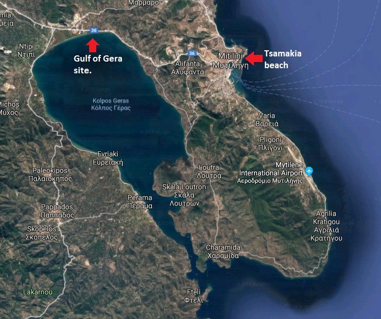
Figure 2. Location of the testing sites in Lesvos island
The first assembly will take place in Tsamakia beach to test the robustness of the proposed pipeline. After the integrity check, the targets will get transferred about ~30 meters from shore and there, divers will anchor the frames. Different Anchoring patterns will take place as mentioned above. After all the data needed from this site is collected, the targets will get withdrawn, disassembled and carried to the next site, Gulf of Gera. On the second site, the target will get assembled again and an integrity check will take place. After the setup, there will be a controlled free drifting of the targets with activated GPS. There will be close up monitoring by divers and a boat to ensure that none of the target will go out of control. After all the data has been collected the targets will get withdrawn, disassembled and stored.
Testing on marine litter volume estimation
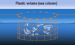
For the first time, dedicated experiments will be carried out to examine the ability of our UAV sensors to estimate the volume of litters in the marine environment. The cube that is presented by the image below is specifically designed for the purpose of the experiment to safely store the volume of litters. The cube will stay submerged as the sensors will be gathering data of the litters contained within just below the sea surface.
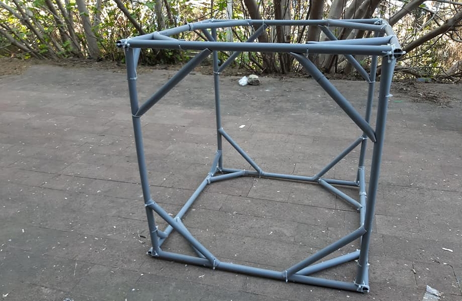
The time frame of the experiment
The experiment will start mid-April and it will be concluded mid-July. The first assembly and integrity check as mentioned above will happen in Tsamakia beach. After the satellite date pass check, the targets will stay anchored until the satellites and UAS (Drones) will have completed the data required. Then the targets will be rearranged in different patterns and the same actions will be repeated. In the second stage, the targets will be transferred to Gulf of Gera. There a free-drifting experiment will take place for two weeks period.
MRSG has gained significant experience in monitoring plastic litter form space and UAVs from #PLP2018. The last year’s scientific results can be found on Topouzelis et al. 2019 (DOI: 10.1016/j.jag.2019.03.011).
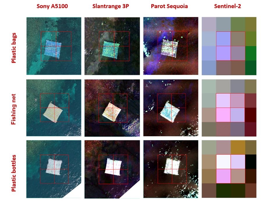
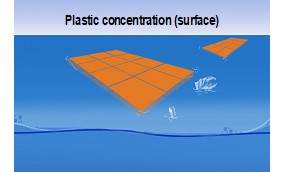
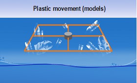
PLP2019 is aiming to test the variability of plastic types, sizes, plastic concentration (surface), plastic volume (sea column) and plastic movement (drifts).
PLP 2019 Experiment Log
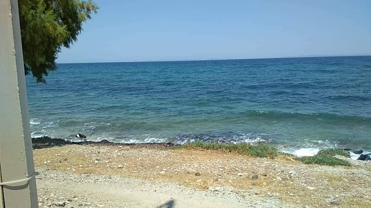
27/06/2019. Last day of the experiment.
Our team gathered at Tsamakia beach at 09:00 am. Today was our last day of the experiment and the plan was to obtain data from UAV and Sentinel-2 satellite images. Unfortunately, the weather conditions were not optimal with high winds and the experiment had to finish without these acquisitions. Our team dismantled the targets in order to store them for future usage.
22/06/2019. Twelfth day of our experiment.
Due to bad weather conditions (~80% of cloud coverage), the experiment was put on hold. Today’s experiment would have been executed with two targets made out of plastic bottles and two targets made out of reeds resulting in a 10x10m mixed target with 75% coverage of plastic bottles in a diagonal formation to each other. The experiment is postponed to 27/6.
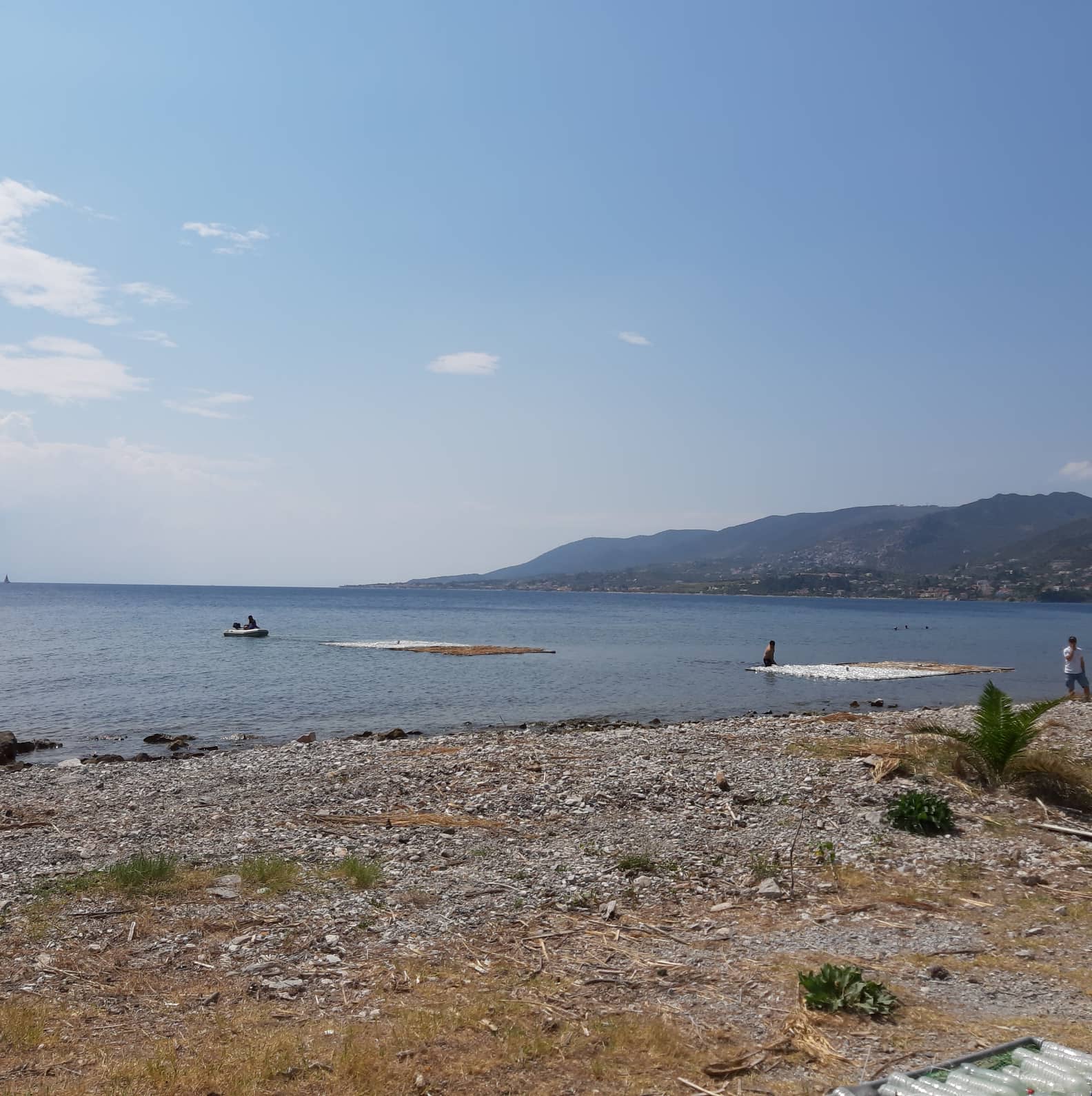
17/06/2019. Eleventh day of our experiment.
Today our team gathered at Tsamakia beach at 9 am. This time four targets of 5x5m were deployed in a square pattern resulting in a big 10x10m target. Two targets were covered with Reeds and the other two with plastic bottles all in 100% coverage. In this bigger target the bottles and the reed were put diagonally from each other. Sentinel-2 satellite overpassed approximately at 12 pm and several images were also taken from a drone, mounted with an RGB camera. In addition, four GPS modules were mounted on the 5x5m targets in order to acquire accurate position data.
12/06/2019. Tenth day of our experiment.
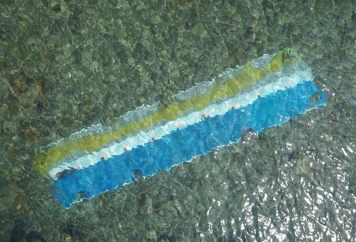
Due to bad weather conditions, the experiment was put on hold. However our team did some field work such as constructing a 1x5m target in order to work with volume estimation. Also we performed some changes to the cube such as removing the bottles and adding some reeds, plastic materials, nets etc. Furthermore two reed targets of 2.5×2.5 m was tested with 50% plastic bag coverage (50% reeds 50% plastic bags). For all of the previously mentioned targets we gathered data from UAVs for various heights ranging from 5m to 35m.
07/06/2019. Ninth day of our experiment, the World Oceans Day.
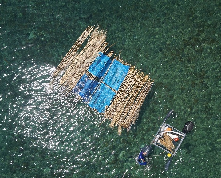
Celebrating tommorow’s World Oceans Day 2019 the PLP19 group organized today’s experiment with an informative and educational scope. The rector of the University of the Aegean Chryssi Vitsilaki was present overwatching the experiment and emphasizing the importance of the initiative. Hoping to spread awareness for the marine plastic litter pollution to the general public we invited the national television channel ERT3 to cover the process of the experiment as well as offering special interviews with the group’s members to talk about the need to keep our oceans clean and how our project can benefit this cause.
Today we prepared an integrated iteration of the project by deploying the surface targets and the submersible cube. The surface targets were three, one was covered by natural materials (branches, leaves etc.) and the other two were covered by plastic bottles but had different dimensions. The Sentinel-2 gathered data over the study area at around 12:00 am and deployed the MRSG UAV S1000 to sample the targets’ surfaces. The UAV was mounted by both the RGB camera and the SlantRange Sensor. We closed the day by cleaning litter from the beach and pay our respect to the ocean that now needs our help more than ever.
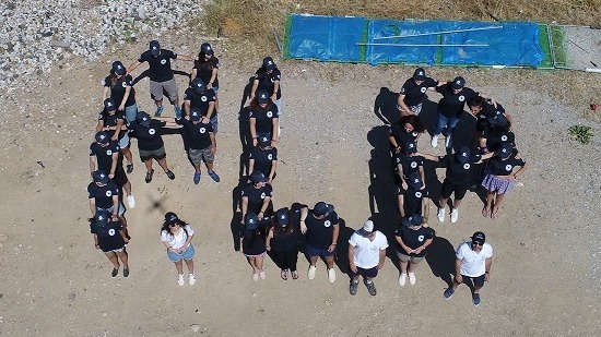
02/06/2019. Eigth day of our experiment.
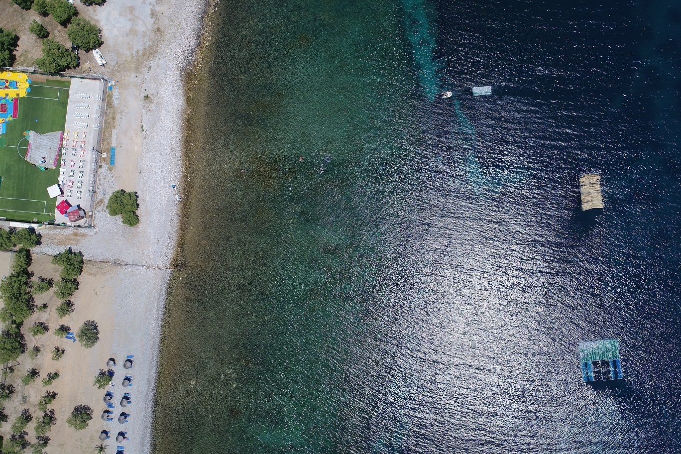
Today our team gathered at Tsamakia beach at 9 am. Due to bad weather conditions (Nearly 100% of cloud coverage), the experiment was put on hold. However our team did some field work such as upgrading the 1x1m cube with a black bottom to exclude reflectance from seafloor, added fishing nets inside the cube and also changed the buoy’s location outside of the Cube. Furthermore a 5X5m target with 100% coverage of reeds was tested with success.
30/05/2019. Second volume estimation experiment.
Today we performed the second marine litter volume estimation experiment. Because the satellite Sentinel-2 was not scheduled to pass over the study area we could not deploy the buoyant targets and instead we prepared the submersible cube to gather data with our UAV. In total we repeated the experiment three times each one with different litter volumes. The first time we left the cube empty in order to gather reference data, the second time we put inside it 100 plastic bottles and 100 bottle labels, for the third repeat we doubled the volume with 200 plastic bottles and 200 labels in total.
The experiment began at approximately 11:00 am using the octacopter S1000. The UAV was mounted with a Sony RGB camera and the SlantRange sensor which is calibrated to match the Sentinel-2’s wavelength and bandwidth of the Blue, Green, Red and NIR bands.
28/05/2019. Seventh day of our experiment.
Today our team gathered at Tsamakia beach at 9 am. This day, four targets (5x5m) were deployed in pairs (two targets covered with plastic bottles and the other two with plastic bags). There was a change on the coverage of the targets so that in this iteration each target was 50% covered by the plastic products. Furthermore there were two additional deployments, one target with dimensions 2x5m, covered 100% by plastic bottles and a 1 m^3 cube filled with 100 bottles and 100 bottle etiquettes.
All the targets were placed in the water at 09:30 am and by 10:28 am they were in their final positions. Sentinel-2 satellite overpassed approximately at 12 pm and several images were also taken from a drone, mounted with both an RGB camera and a SlantRange sensor. In addition, four GPS modules were mounted on the 5x5m targets in order to acquire accurate position data.

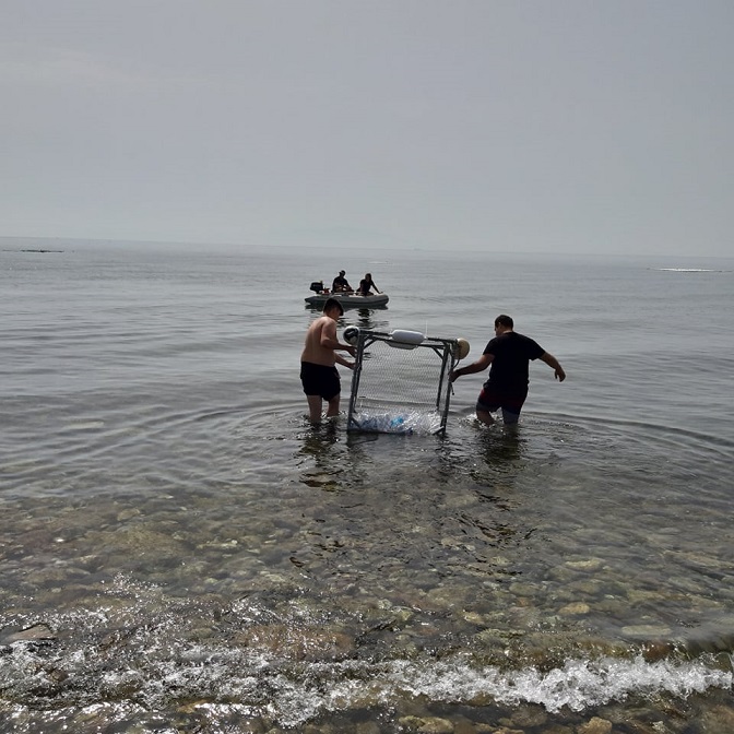
23/05/2019. Sixth day of our experiment.
On 23/05 at 09:00 am the weather was cloudy with light rain showers and the experiment had to be postponed until the 28th of May. At that day the iteration will have the same specifications as it was planned for today.
18/05/2019. Fifth day of our experiment.
Today was another successful day for the team of PLP2019. The team gathered at 8 am. The targets started going on the water at 8.30 am and got into final position at 9.15 am. The experiment was a repetition of the experiment on 13/05 in order to collect more data.
13/05/2019. Fourth day of our experiment.
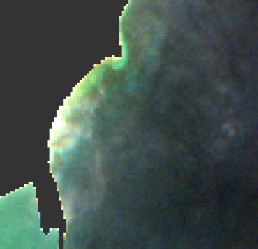
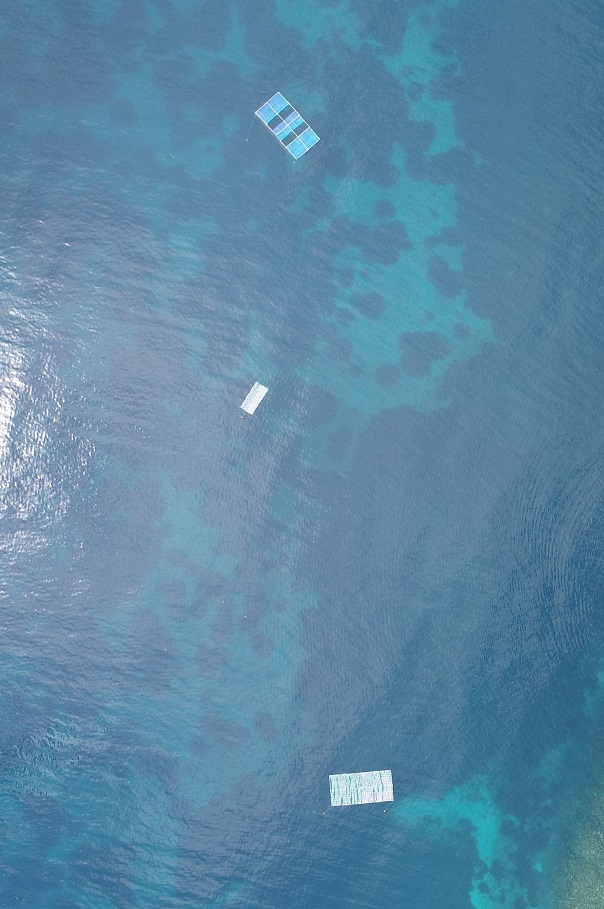
Our team gathered at Tsamakia beach at 9am. In this iteration we deployed five targets. The dimensions of the first four were 5x5m and they had a 75% coverage of plastics, two targets were covered by plastic bottles and the other two by plastic bags. The fifth target, whose dimensions were 2x5m was 100% covered by plastic bottles. The distance between the targets was 20 meters.
The targets were placed in the water at 11:06 am and by 11:52 am they were in their final position. Sentinel-2 satellite overpassed approximately at 12 pm and several images were also taken from a drone, mounted with an RGB camera.
08/05/2019. Third day of our experiment.
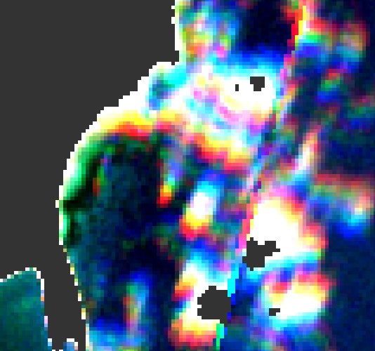
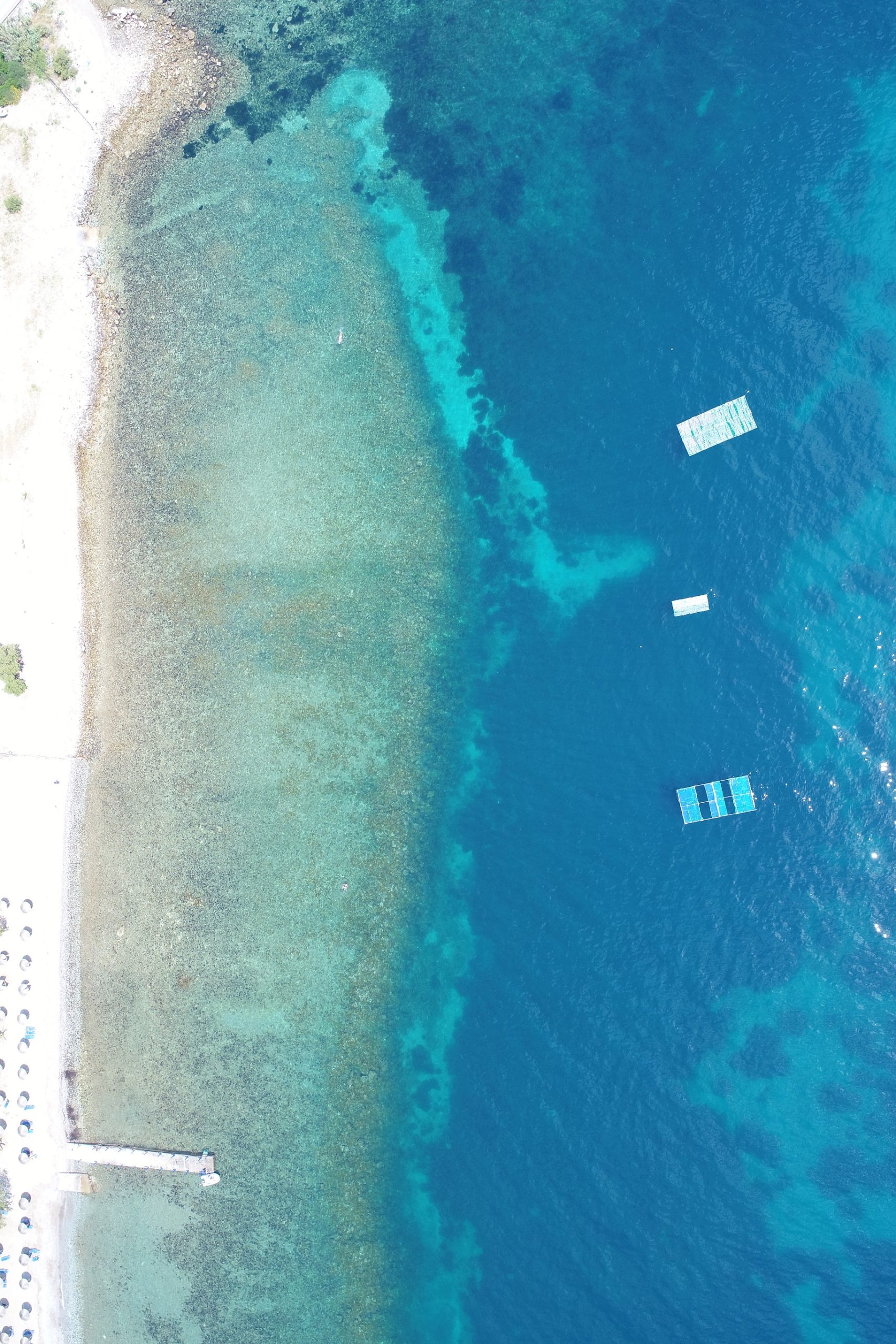
Our team gathered at Tsamakia beach at 9 am. We prepared four of our targets, two with plastic bottles and two with plastic bags. This time the targets were not fully covered by plastic but instead they had a 75% coverage. By 10:20 am we were forced to retrieve the targets due to the bad weather and troubling sea condition.
03/05/2019. Second day of our experiment.
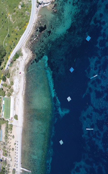
Today was the second successful day of our experiment. The team gathered at 9 am and the targets started going in the water at 9:55 am. They got into final position at 11:00 am for the Sentinel-2 pass that happened at 12:00 pm. Today we deployed six targets. The dimesions of the first four were 5x5m and and 1x5m for the other two. The targets had a 20m space between each other to secure that they will be represented by different pixels in the Sentinel-2’s image. Several images were also taken from one of our drones , mounted with an RGB camera in order to make a comparison between drone data and Sentinel-2’s data.
18/04/2019. The first experiment.
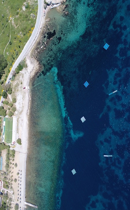
Today was the fist day of our experiment. Our team gathered at 9am and had a last check on the four targets. The targets were already tied to the moorings by 12pm (the time Sentinel-2 was expexted to pass over Tsamakia beach). As for today, the targets were next to each other with no space in between them forming a 5x20m target. An image was also taken from one of our drones, which had an optical RGB camera mounted on, in order to compare our data with Sentinel-2’s data.
17/04/2019. General Rehearsal.
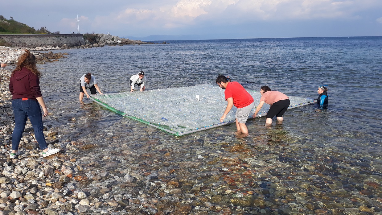
Today we made the general rehearsal before the experiment. Twenty of us gathered in the Tsamakia beach. Two of the targets (one with plastic bags and one with plastic bottles) were carried over from their ground location into the water. With the help and effort of our two divers the targets were transported and tied to the moorings (already set in the water from yesterday) and then transported and carried over back to their initial locations. The whole rehearsal was timed (from the moment we picked the targets till we returned them back) and an estimation of the time-length for our preparation before the satellites pass by was made. We are ready and positive about tommorow’s experiment.
16/04/2019. Preperations for the pilot testing.
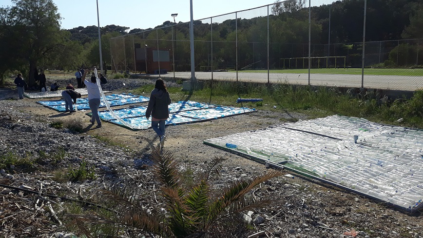
Today we gathered at Tsamakia beach and prepared four artificial targets, all four targets were 5X5 m. (5 m2) in size. The target frames were PVC tubes of 50 cm in diameter (ø), all joined by PVC welding material and fasteners. A mesh was installed that filled the frame, to act as a holding net for the plastics that were mounted. These controlled targets were filled (secured by fishing line) with two types of plastics.
- Two of the targets were filled with plastic bottles made from PET-1 (Polyethylene terephthalate).
- The other two with low-density Polyethylene (LDPE) plastic bags.
A GPS module was positioned at the center of each target (above the sea level) and was tied up with fasteners to secure it won’t get lost. Furthermore, 8 moorings were prepared for our targets aboard a boat with the help of a diver and their exact location was pinpointed with GPS. We also practiced on our coordination on how to move the targets in and out of the water efficiently quickly and safely to avoid any accidents on the actual experiment.
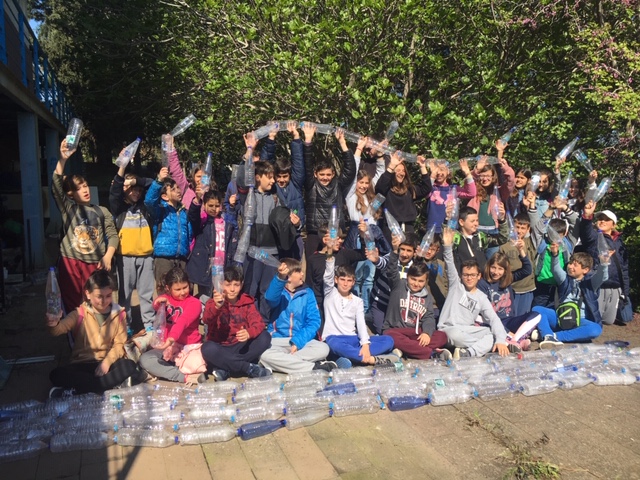
Meanwhile, in the morning 30 students and their teachers from the primary school of Vareia visited the University of the Aegean in Mitilene. The students were given a presentation and were informed by members of the team about the project, as well as the global issue with marine plastics and the numerous problems they present. We talked about how satellite imagery can be used in detecting plastics in the ocean and about how we can all do our part in the effort to reduce single use plastics.
After the talk and presentation, the students were shown the targets during the final stages of construction and helped with making some of the rows of plastic bottles. They were amazed by the amount of plastic bottles that were able to collect in a short time and were all interested in the project and eager to help clean up the ocean!
For more info:
https://www.facebook.com/MRSG.Aegean
https://www.instagram.com/UoA_mrsg
Media:
BBC (12/4/2019) Can you spot ocean plastic from space?
stonisi.gr (18/4/2019) Κι άλλο πρωτοπόρο πείραμα ξεκίνησε από τη Λέσβο!
stonisi.gr (28/04/2019) Όταν οι δορυφόροι εντοπίζουν το πλαστικό… από τα Τσαμάκια!
ant1news.gr (08/05/2019) Ημερίδα για την προστασία του περιβάλλοντος – ΥΓΕΙΑ – ΠΕΡΙΒΑΛΛΟΝ
webtv.ert.gr (07/06/2019) Τα drone στην υπηρεσία για των καθαρισμό των ακτών