Equipment
UAS
UAS
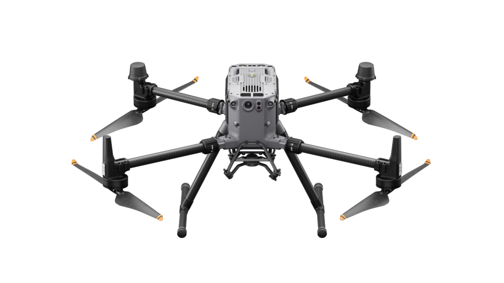
DJI – M350 RTK
RTK system for centimeter-level positioning accuracy
Maximum flight time up to ~55 minutes
Multi-payload support (LiDAR, RGB, and thermal cameras)
Weather-resistant design (IP55 rating) for operation in harsh conditions
Advanced obstacle avoidance system for safer navigation
Long transmission range with stable and reliable connectivity
Simultaneous support for up to 3 sensors for enhanced data acquisition
UAS
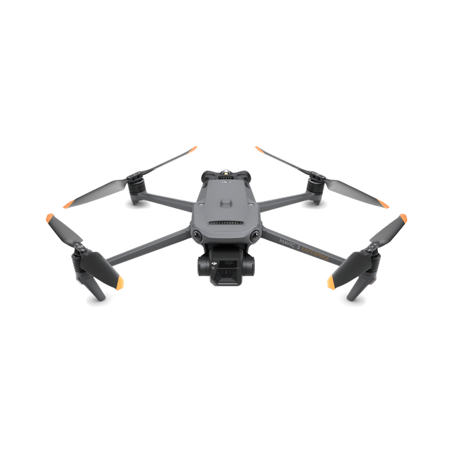
DJI – MAVIC 3E
RTK system for centimeter-level positioning accuracy
Maximum flight time up to ~45 minutes
Multi-payload support (RGB, zoom, and thermal – e.g., Mavic 3T version)
Limited weather resistance (no official IP rating)
Advanced obstacle avoidance system for enhanced flight safety
Long transmission range with stable and reliable connectivity
Support for multiple sensors for flexible data collection
UAS
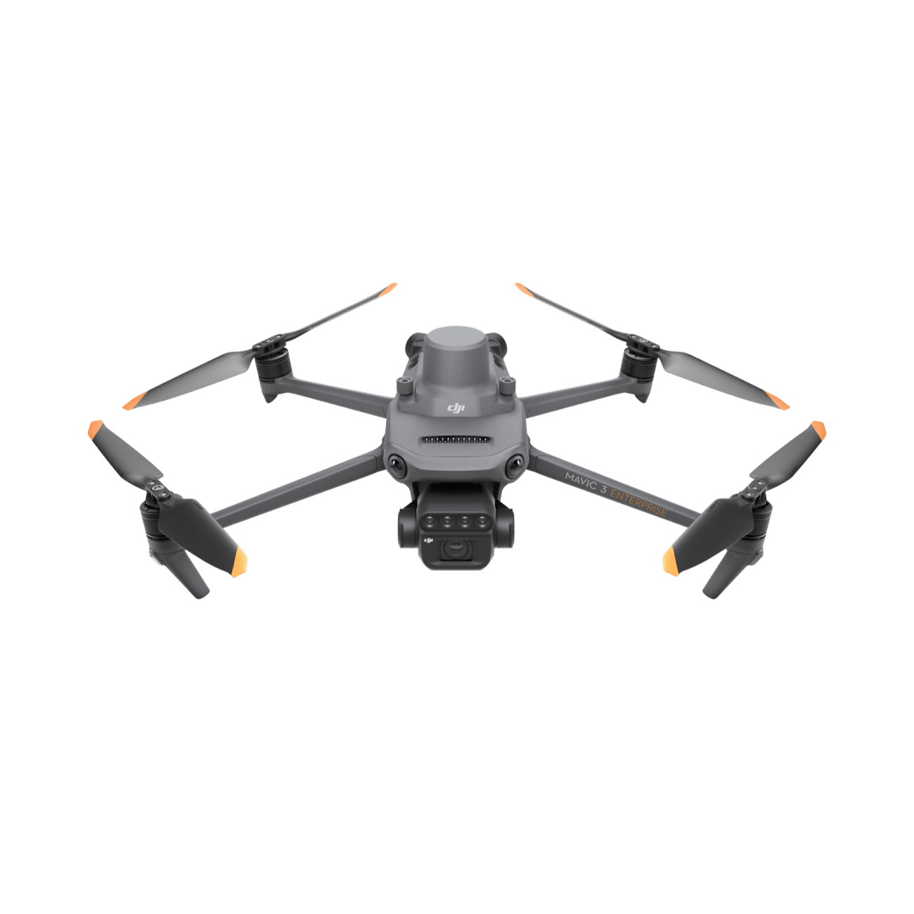
DJI – MAVIC 3M
Integrated RTK system for centimeter-level positioning accuracy
Maximum flight time up to ~43 minutes
Multi-sensor support (RGB + multispectral cameras for agricultural applications)
Limited weather resistance (no official IP rating)
Advanced obstacle avoidance system for improved flight safety
Long transmission range with stable and reliable connectivity
Simultaneous use of multiple cameras/sensors (1 RGB + 4 multispectral) for comprehensive data capture
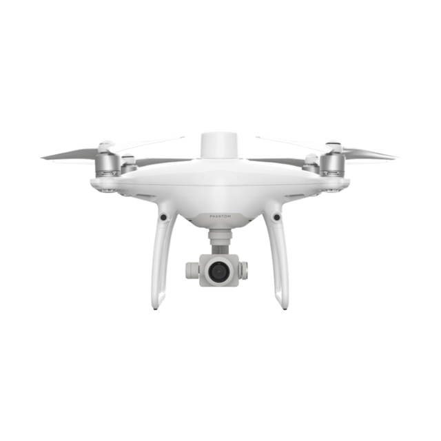
UAS
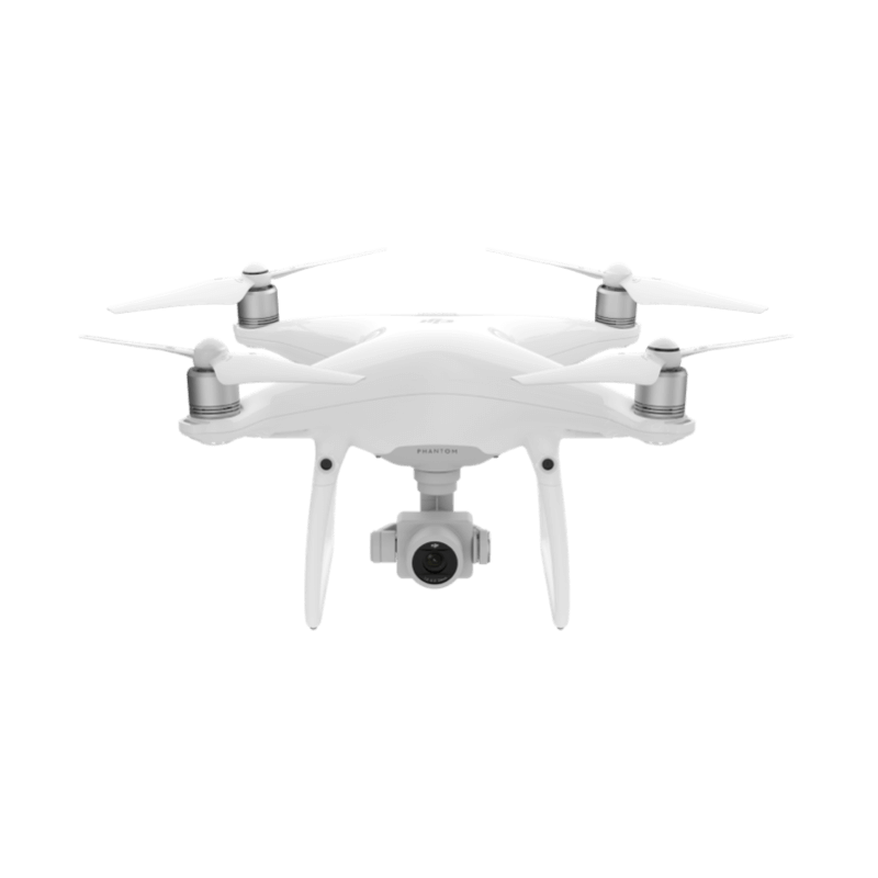
DJI – PHANTOM 4
No RTK system (standard GPS positioning)
Maximum flight time up to ~28 minutes
Integrated RGB camera for general imaging tasks
Limited weather resistance for operation in mild conditions
Basic obstacle avoidance systemLong transmission range with stable and reliable connectivity
Autonomous flight and tracking capabilities for simplified operations
UAS
DJI – PHANTOM 4 PRO RTK
RTK system for centimeter-level positioning accuracy
Maximum flight time up to ~30 minutes
Integrated 20MP RGB camera (1-inch CMOS sensor, mechanical shutter)
Limited weather resistance (no official IP rating)
Advanced obstacle avoidance system (forward, backward, and downward sensors)
Long transmission range with stable and reliable connectivity (up to ~5–7 km)
High mapping accuracy enabled by TimeSync and GNSS/RTK integration
UAS – Fixed Wing
H2O Hydro Hexacopter
UAS – Fixed Wing
Phoreas
UAV
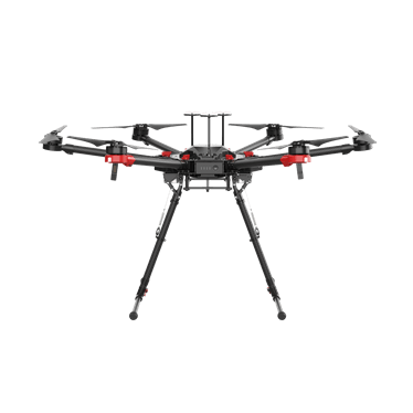
UAV
DJI – M600 PRO
No RTK system (standard GNSS positioning)
Maximum flight time up to ~35 minutes
Support for heavy payloads for specialized missions
No IP rating (limited resistance to harsh weather conditions)
No integrated obstacle avoidance system
Long transmission range via Lightbridge 2 with stable connectivity
Support for multiple sensors for flexible data acquisition
UAV
UCANDRONES – MERA (Custom Made)
UAV
ALTUS – ATLAS 204 v.Phorcys
UAV – Fixed Wing
ALTUS – CETO
Sensors
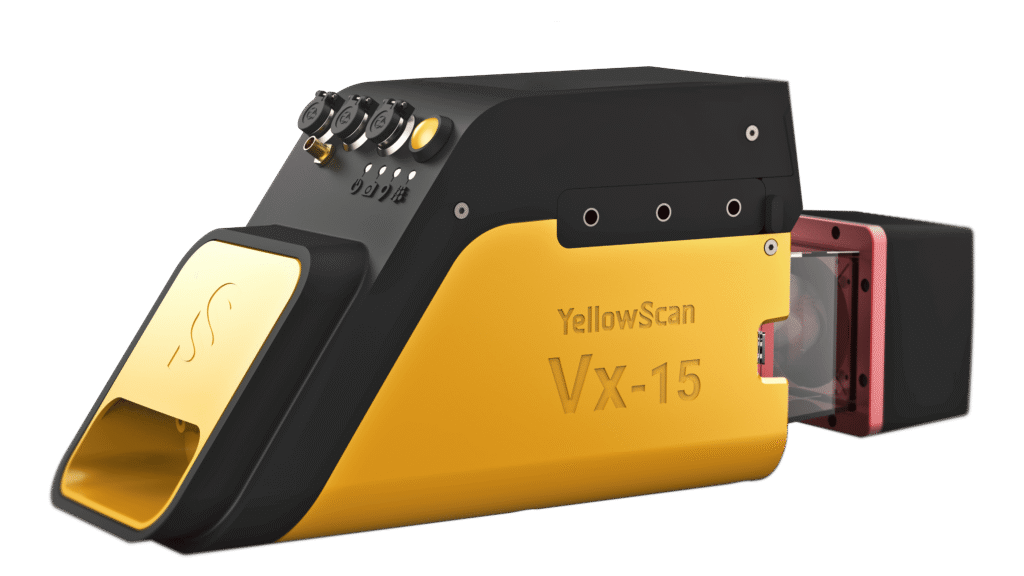
SENSOR
YELLOWSCAN – VX-15
RTK/GNSS + IMU system for centimeter-level positioning accuracy
Operational endurance up to ~1.5 hours
LiDAR sensor support for high-precision 3D mapping
Suitable for complex environments (dense vegetation, rugged terrain)
Extended scanning range with full 360° coverage
Multiple return capability (multiple echoes) for enhanced surface detection
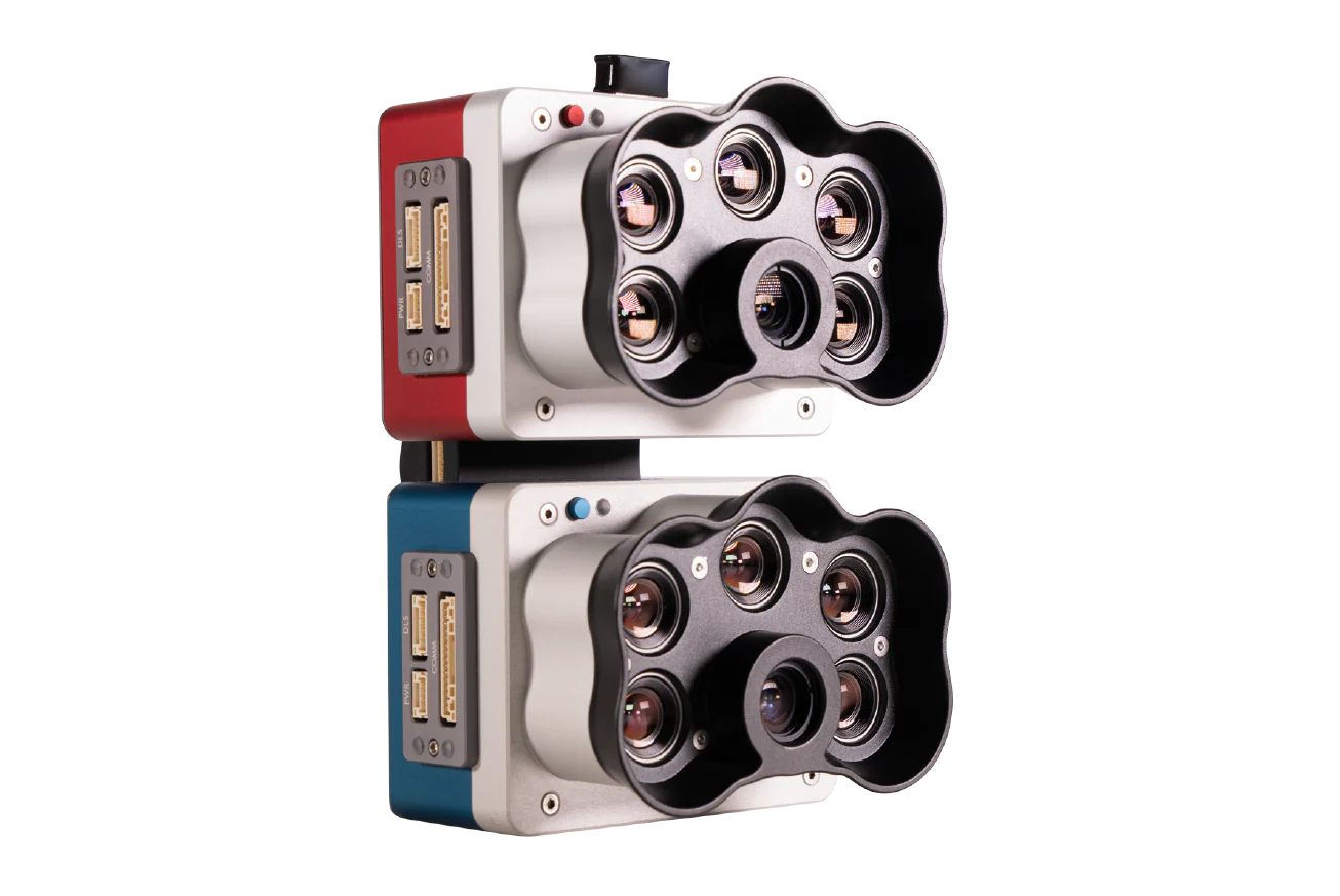
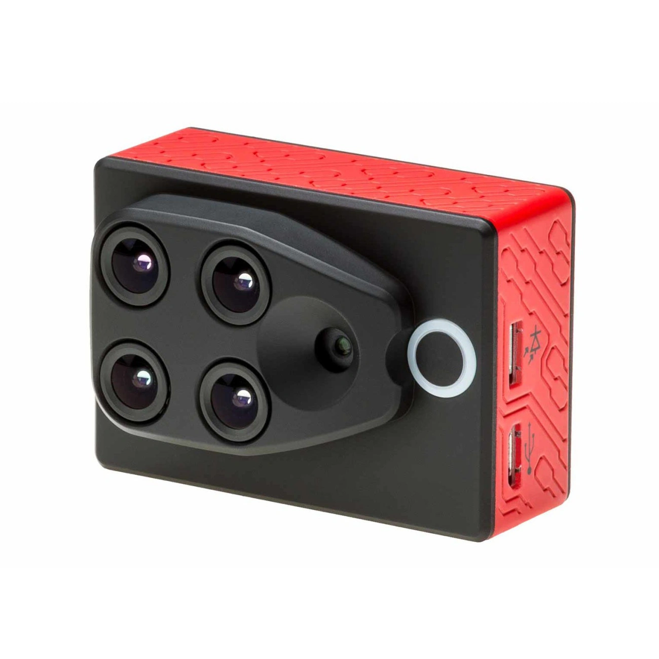
SENSOR
MICASENSE – RedEdge-P DUAL
Synchronized multispectral acquisition using a dual system (10 spectral bands)
Support for RGB + multispectral sensors for precision agriculture applications
High georeferencing accuracy through RTK drone integration
Suitable for professional applications (agriculture, environmental monitoring, research)
High data resolution and accuracy for detailed analysis
Simultaneous operation of multiple cameras (dual setup) for enhanced data capture
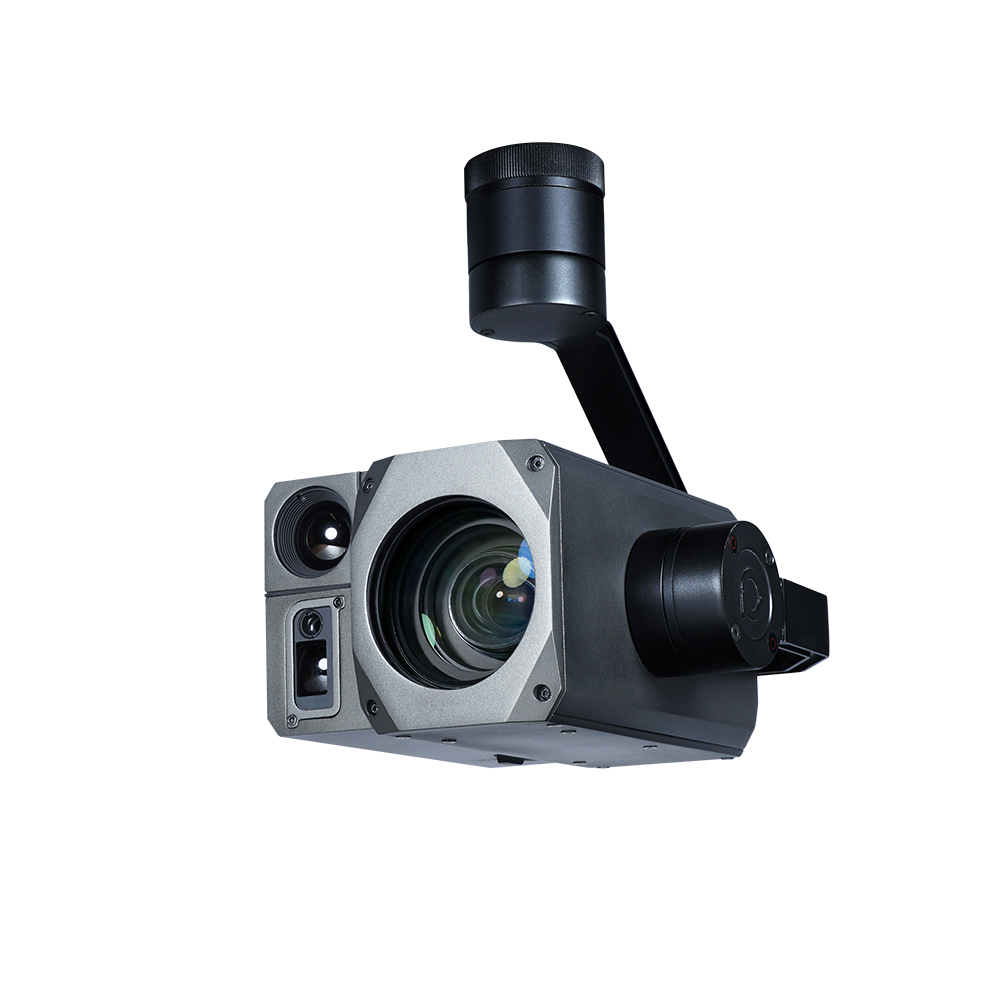
SENSOR
VIEWPROTECH – H30T
EO + IR + Laser Rangefinder payload (triple sensor: optical, thermal, and distance measurement)
Optical camera with 30× optical zoom and up to ~432× hybrid zoom
Thermal camera (640×512, VOx, 8–14 μm) for temperature detection and monitoring
Laser rangefinder with a range of up to ~1–1.5 km
High-precision 3-axis stabilized gimbal for steady imaging
AI-based object tracking capabilities
Suitable for professional applications (surveillance, search & rescue, inspections)
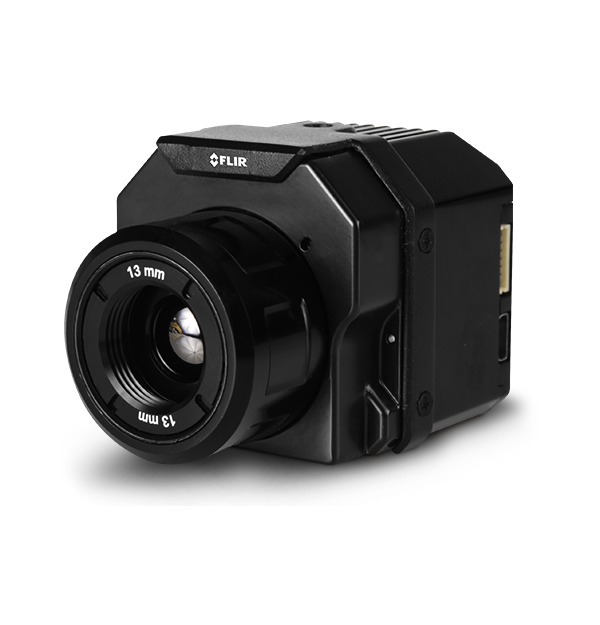
SENSOR
FLIR – VIEW PRO R
Thermal sensor (LWIR) for accurate temperature measurement
Resolution up to 640×512 for detailed thermal imaging
Spectral range: 7.5–13.5 μm for long-wave infrared detection
Per-pixel temperature measurement for precise thermal analysis
MAVLink compatibility for seamless drone integration and control
Flexible lens options (various FOVs depending on application needs)
Suitable for professional applications across multiple domains
SENSOR
PARROT – SEQUOIA
Multispectral sensor (4-band) for vegetation and environmental analysis
Integrated 16MP RGB camera for high-quality visual mapping
Synchronized multispectral + RGB data acquisitionBuilt-in GPS and IMU for accurate image georeferencing
High capture rate (up to ~1 image per second)
Lightweight and compact design (~100–135 g) for easy drone integration