EQUIPMENT
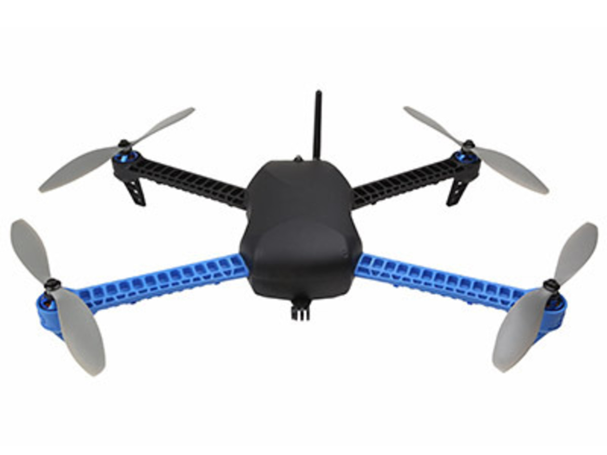
Iris Quadcopter
MRSG bougth in 2014 this drone with the cooperation of the CartoGI Laboratory for studying the potential use of drones in spatial data aquisition.
3D Robotics (3DR) Iris is one of the first advanced quadcopter with full GPS-guided autonomous capabilities. Iris is designed to provide an “out-of-the-box” flying experience that brings the power of professional grade aerial robotics to the mass market.
Iris can be controlled by an Android tablet or phone or through a nine-channel radio control transmitter.
With the mobile app, take off and landing can be done with a single touch, and mission planning is as simple as tapping on a map and drawing a path that Iris will follow.

3IRIS is designed with a wide angle between the front arms to provide a clear view for its onboard camera. The arms and legs are produced from Zytel Nylon ® for the ultimate in wear, abrasion and impact resistance. They come in various colors, and are easily and inexpensively replaced if required.
Iris sports a high-performance 32-bit autopilot system built on an ARM Cortex-M4 processor that runs a real-time operating system and uses the latest ST Microelectronics sensors. The flight code represents over four years of professional development and testing in a community of over 40,000 users. Iris also features an integrated power-distribution/motor-control board to reduce weight and increase available payload capacity. All of Iris’s electronics are housed under a sleek shell that provides impact protection and aerodynamic efficiency.
Iris includes an impressive list of features such as:
- Multiple control options provide redundancy and flexibility: RC, computer, phone, tablet
- Built-in data radio for real-time mission monitoring, data-logging, and control
- Powerful cross-platform ground station/mission planning and analysis software that runs on Windows, OS X and Linux, providing simple point-and-click programming and configuration
- Mobile apps allow intuitive “draw a path” mission-planning
- Camera options include a live video link with programmable on-screen-display, and will soon support a fully integrated stabilized camera gimbal with autopilot control
- GoPro® compatible camera mount
- A 9-channel RC transmitter pre-programmed for the most popular flight modes.
- Pre-programmed GPS waypoints allow for professional-grade mission capabilities, such as mapping, scripted cinematography, scientific research, and other applications where repeatable flight plans are required
- Auto takeoff and landing along with Return-To-Launchpoint command at the press of a button or under programmable failsafe conditions
- Follow Me function for the ultimate “selfies”. In this mode, Iris will follow (at an adjustable distance) any ground station device equipped with a GPS antenna and one of our 3DR telemetry/control radios
- Geo Fencing provides a virtual box to keep your drone within a user-selectable space
- Open source flight code, ground station software and electronics are all freely distributed under standard open source licenses. This means that Iris’ capabilities are always improving and expanding with a simple firmware update!

