Marine Remote Sensing Group
A Window to the Coastal World
WE ARE A RESEARCH GROUP LOCATED IN MYTILENE, GREECE
The Marine Remote Sensing Group (MRSG) at the University of the Aegean has been conducting research for the exploration, analysis and visualization of the satellite and UAV data in the coastal environment since September 2014. We combine state-of-the-art algorithms and in situ measurements to develop new methods, technologies, and products for the visual representation of marine geospatial information. The group has gained expertise in several disciplines of marine remote sensing including oil spill detection, oceanic phenomena identification, seagrass mapping, coastal bathymetry and coastline detection. Hereafter we present ongoing and completed research projects.
LET’S WORK TOGETHER!
Research expertise
We specialize in marine remote sensing, combining satellite data, UAV imagery, and geospatial analysis to monitor coastal environments, assess marine habitats, and support sustainable management.

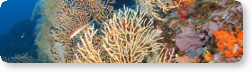
UAS Marine Habitat Mapping
High-resolution drone mapping of shallow marine ecosystems for habitat monitoring and management.
Satellite Oceanography
Satellite-based analysis of ocean processes, supporting fisheries management and environmental monitoring.

Coastal Change Monitoring Using Airborne LiDAR
Multi-sensor remote sensing approaches for monitoring shoreline dynamics and coastal change.

Remote Sensing of Marine Debris
Remote sensing and machine learning approaches for detecting floating marine litter and monitoring coastal environments.

Floating Marine Debris Detection using Satellite and UAV Imagery
Multi-scale satellite and UAV approaches for the detection and monitoring of floating marine debris.
WE WORK WITH
Our Partners


Get in touch with the MRSG
If you are interested in collaboration, research projects, or would like to learn more about our work, feel free to reach out!
From the News
Latest News
-
Hello world!
Read more: Hello world!Welcome to WordPress. This is your first post. Edit or delete it, then start writing!